
| Home Page | |
| FAQ | |
| Publications | |
| Documentation | |
| Software | |
| Movies | |
| Image Gallery | |
| Image Data | |
| Validation | |
| Data Search | |
| Derived Products | |
| Related Links | |
| Contact Us | |
| SCP file site | |
2017-2021 (Brigham Young University) Iceberg A68 calved from the Larsen C Ice Shelf on the Antarctic Penninula in July 2017. For a long time it did not move much. Finally, in 2018 it started moving northward, rotating several times. In 2019 it left the Weddell Sea. Moving northward, it was caught in the Antarctic Circumpolar current and moved rapidly toward South Georgia Island. It closely approached the west coast of South Georgia before moving south, then east, and breaking up. Fragments moved east of South Georgia Island before melting by April 2021. A68 is a good example of an Antarctic tabular iceberg, which are produced when the end of a floating glacier or ah ice sheet breaks off--termed "calving". As large as A68 was, it is not exceptional either in size or path. Iceberg A43B, which was also from the Larsen C Ice Shelf, followed the same general path as Iceberg A68, and stalled just east of South Georgia for months in 2004. Iceberg A38B grounded for several months just west of South Georgia Island in 2004. These icebergs later brokeup and melted.
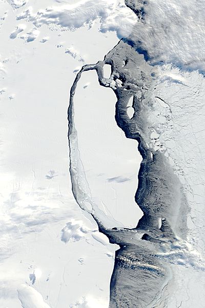
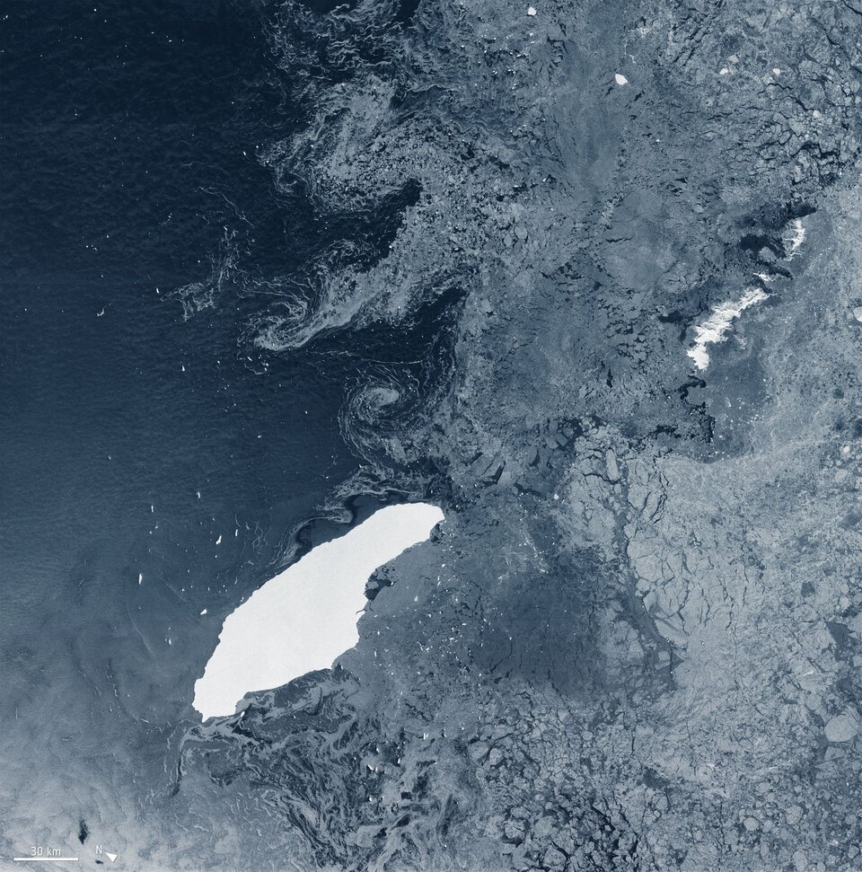
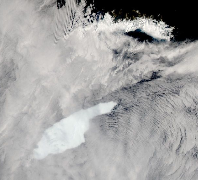
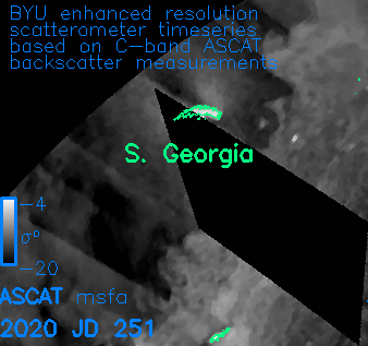
Using satellite scatterometer data, the BYU Scatterometer Climate Record Pathfinder has been generating daily enhanced resolution radar images of the Earth and using the data to track the location of Iceberg A68 and its fragments. (A scatterometer is a type of satellite radar that was originally designed to measure ocean winds from space. BYU repurposed the data to create images to study polar ice, including icebergs.) Several animations of these images are available. Movies of the full life (2017 to present) of A68:
animated gif (330 MB),
mpeg (140 MB), or
mp4 (26 MB). The grey level in the scatterometer images is proportional to the normalized radar cross section (sigma-0) derived from the ESA ASCAT-A and ASCAT-B scatterometers. Glacial ice shows up very bright (white) due to volume scattering of the radar signal from the snow and ice. When the surface melts, the backscatter turns dark. Sea ice is not as bright, and can be seen moving in response to winds and ocean currents. The ocean brightness is highly variable due the effects of the wind on the surface. Calm ocean is dark, but when wind blows, small waves are formed that "roughen" the surface and causes it to look brighter in the radar images. Scatterometers were designed to measure this roughness and determine the wind (speed and direction) over the ocean. Because multiple orbit passes that are collected at different times during the day are combined to create the images there are lines corresponding to swath edges due to the changing wind conditions during the day. The black "diamonds" are where the scatterometer did not collect measurements for that day. The three sections (A, B, and C) of Larsen Ice Shelf existed on the east side of the Antarctic Penninsula for at least 10,000 years. It was much larger a few decades ago, but sections A and B have since collapsed and calved into icebergs such as Icebergs A20 and A68 as a result of warming conditions that weakened the ice shelf. Here is a link to a NASA page showing recent optical images of the iceberg. Other satellite optical images are shown below. Note that BYU follows the U.S. National Ice Center naming and size tracking conventions. Generally only icebergs larger than 4 nautical miles in size are named and tracked, though some smaller ones are occasionally tracked. The full 4 decade-long BYU iceberg database is available here. Note that Iceberg A68 calved in July 2017 into Icebergs A68A and A68B. Iceberg A68C calved from Iceberg A68A in April 2020. The smaller 'bergs are too small to be easily visible in the scatterometer images.
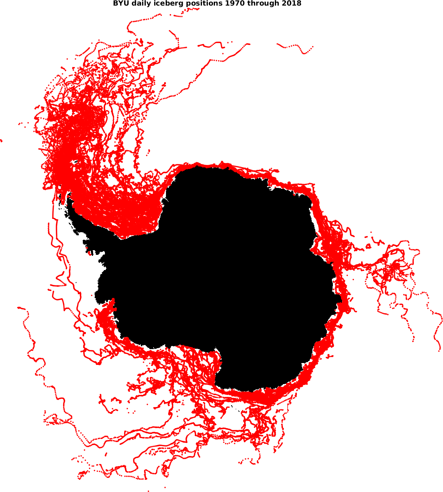
More than 90% of all icebergs calved from Antarctica end up traveling through the Weddell Sea and "iceberg alley". Here is a map of all icebergs tracked by BYU from 1978 through 2018. Animations of the daily movement of selected individual icebergs can be found here. Note that many icebergs do not move for extended periods of time. This movie database is only infrequently updated. Here are additional optical satellite images of A68A. Related scientific papers: Support from both NASA and NSF is acknowledged. Last Revised: 19 May 2021
For further information contact: Dr. David G. Long
long@ee.byu.edu
Microwave Earth Remote Sensing (MERS) Lab: https://www.mers.byu.edu/
|