
| Home Page | |
| FAQ | |
| Publications | |
| Documentation | |
| Software | |
| Movies | |
| Image Gallery | |
| Image Data | |
| Data Search | |
| Derived Products | |
| Related Links | |
| Contact Us | |
| SCP file site | |
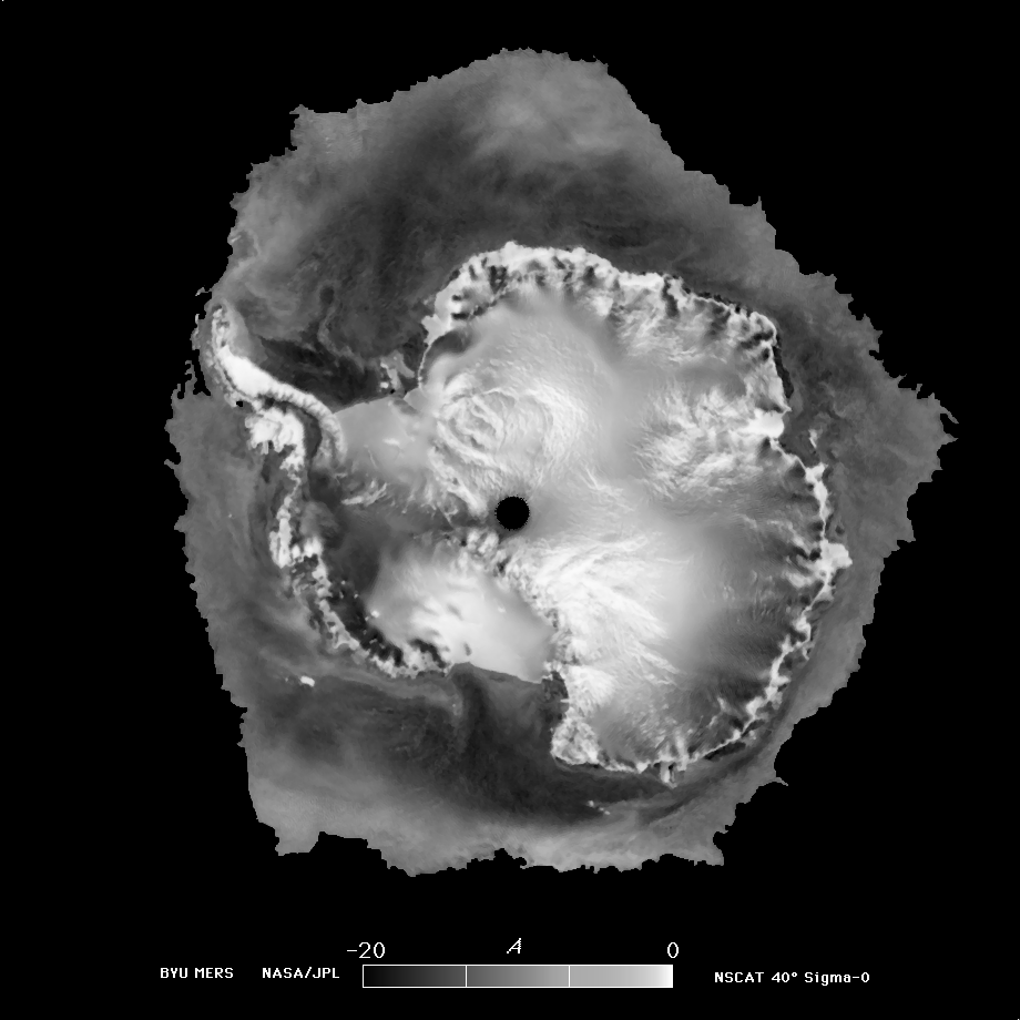
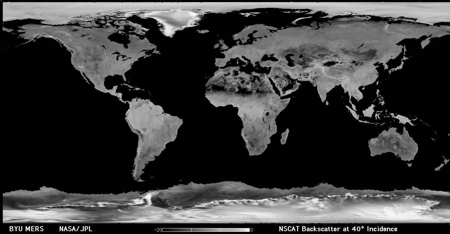
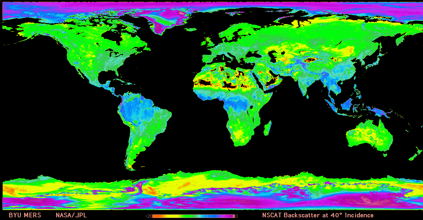
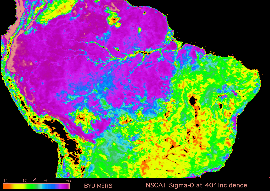
Selected NSCAT Images & AnimationsAntarctic Images Figure 1 (gif 356K) illustrates an image formed from NSCAT sigma-0 measurements and demonstrate the wealth of information contained in the scatterometer data. This image shows Antarctica and the surrounding sea ice constructed from 6 days of scatterometer data in Sept. 1996. The black circle in the center of the image is where no data was collected owing to NSCAT's orbital and sampling geometry. The dark band around the continent is sea-ice pack surrounding Antarctica. The variations in sea ice show the circulation patterns and are due to the snow cover, thickness, and history of the ice since formation. This information is essential to understand the effects of the ice pack on the ocean and climate systems. The white, rectangular object in the ice pack on the lower left of the image is the the B10A 50 km x 100 km "super-berg" which broke off the Thwaites ice tongue in 1995 and circulate in the sea-ice pack until breaking up north of South Georia Island in Jan. 2000. Other large icebergs are also visible in the image. Antarctica is overed with a thick ice sheet which appears very bright in the image due to snow crust and refrozen ice in the snow cover. Details visible in the glacial ice cover show the locations of ice "hills" and "valleys" which reveal information about the flow of the ice over the subsurface topography. Global Image A full global image as produced from NSCAT data is shown in Figure 3 (b/w gif 402K) (color gif 383K) . The brightest regions are glacial ice sheets in Greenland and Antarctica as described above. For other regions, the brightness of the image is related to the vegetation cover and soil moisture. Tropical rainforests along the equator in South America, Africa, and Southeast Asia are relatively bright while desert regions are dark. Very dry, sandy deserts show up as black in this image. Some examples are the Empty Quarter in Saudia Arbia, the Gobi desert in Western China, and the great erg (sand dune) seas in Sahara desert in North Africa. The light area just below the wide, dark band in Africa is known as the Sahel. This area lightens and darkens with the changing season and drought conditions in Africa. The seasonal radar response of the Sahel is thought to be a sensitive indicator of desertification due to global warming and climate change. Tropical Rainforest Tropical rainforests are critical to the climate health of the world and are thought to contain 1/2 of all the world's species. Figure 4 [hires b/w gif 523K] [lores b/w gif 99K] [color gif 492K) shows the Amazon rainforest over South America as observed by NSCAT. Because the radar response is sensitive to the type and density of vegetation, the scatterometer data can provide information useful for discriminating and mapping vegetation. A false color image helps discriminate general areas of tropical rainforest (blues and purples) from woodlands and savannah (greens and yellows). Mountains and degraded farm lands show up as black. [Note: data is not calibrated so this IS NOT a classified image.] The NSCAT data is able to delineate the extent of the tropical rainforest. NSCAT Probability Distribution NSCAT employed an onboard digital Doppler processing for along-beam resolution. As a result it is possible to derive analytic expressions for the probability density distribution of the noise-like scatterometer measurements. This can be helpful when examining the temperature and low wind speed sensitivity of Ku-band measuements. An example |
![[hires b/w gif 523K]](NSCAT/NSCAT_415-631_cal4.gif)
![[lores b/w gif 99K]](NSCAT/NSCAT_amazon_lowres.gif)