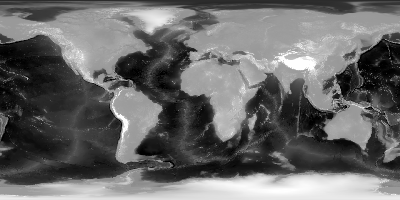
| Since topographic data can be very useful in a comprehensive
analysis of climate data, the Scatterometer
Climate Record Pathfinder project has produced topography files for
each of its standard processing regions with resolutions matching each sensor
image product. The topography data is stored in the same format and projection
as the standard products to simplify its use. The polar projections are polar
stereographic while non-polar regions are Lambert equal area projection.
The topography information is derived from the ETOPO2
gobal elevation dataset, a 2 minute pixel resolution data set available
from NOAA. For each SIR pixel, the ETOPO2 resolution element closest to
the center of the SIR pixel is assigned as the height (in meters) of that
SIR pixel. While a good database, the ETOPO2 database is limited by the
source used to generate it and has limited accuracy in some areas (notably
at the poles).
|
Available Topography Image files
(in gzipped SIR format)
| Region |
ERS
SSM/I
AMSR-E
|
SASS
NSCAT
QuikSCAT eggs
SeaWinds eggs
ASCAT
OSCAT eggs
|
QuikSCAT slices
SeaWinds slices
OSCAT slices
|
nominal resolution
(km/pixel) |
8.9
|
4.45
|
2.225
|
| Alaska (Ala) |
|
|
|
| Antarctic (Ant) |
|
|
|
| Arctic (Arc) |
|
|
|
| Australia (Aus) |
|
|
|
| Bering Sea (Ber) |
|
|
|
| Central America (CAm) |
|
|
|
| China/Japan (ChJ) |
|
|
|
| Europe (Eur) |
|
|
|
| Greenland (Grn) |
|
|
|
| Indonesia(Ind) |
|
|
|
| North Africa (NAf) |
|
|
|
| North America (NAm) |
|
|
|
| South Africa (SAf) |
|
|
|
| South Asia (SAs) |
|
|
|
| Siberia (Sib) |
|
|
|
Also available directly from the Scatterometer Climate Record ftp site.
|