|
(Note: the Japanese ADEOS-II mission was renamed
to Midori-2 in mid-2003, though ADEOS-II is used in this site for historical reasons.)
SeaWinds on ADEOS-II and SeaWinds on QuikSCAT are identical instruments and
have been carefully cross-calibrated. The orbit phasing is such that they observe the same
location at different local-times of day, however.
The wide swath and frequent overflights permit generation of a wide variety
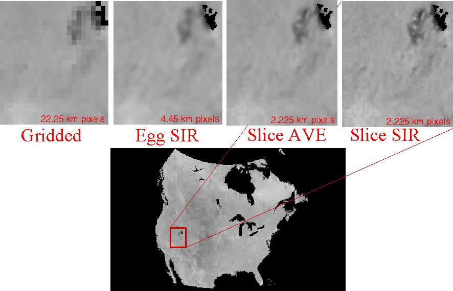
of SeaWinds Image products. For highest possible spatial resolution, multiple
orbit passes are combined. These are the 'all pass' images. Since generally
orbit passes of a given point on the Earth occur at nearly the same time
of day, time-of-day studies are facilitated by computing images from ascending
(morning) passes only, and descending (evening) passes only.
For improved temporal resolution in the polar regions, daily
local-time-of-day images have been generated.
Images are made both from the SeaWinds on ADEOS-II "egg" backscatter
measurements and from the "slice" measurements. Generally, slice measurements
yield higher spatial resolution but are noiser than egg measurements. The nominal image pixel resolution for egg images is 4.45 km/pixel while the nominal image pixel resolution for slice images is 2.225 km/pixel.
Further information is available in the QuikSCAT/SeaWinds
Enhanced Resolution Image Users Notes.
|
Available Image Classes
* Note: Only Ant, Arc, and Grn regions available in these local-time-of-day images
|