
| Home Page | |
| FAQ | |
| Publications | |
| Documentation | |
| Software | |
| Movies | |
| Image Gallery | |
| Image Data | |
| Data Search | |
| Derived Products | |
| Related Links | |
| Contact Us | |
| SCP file site | |
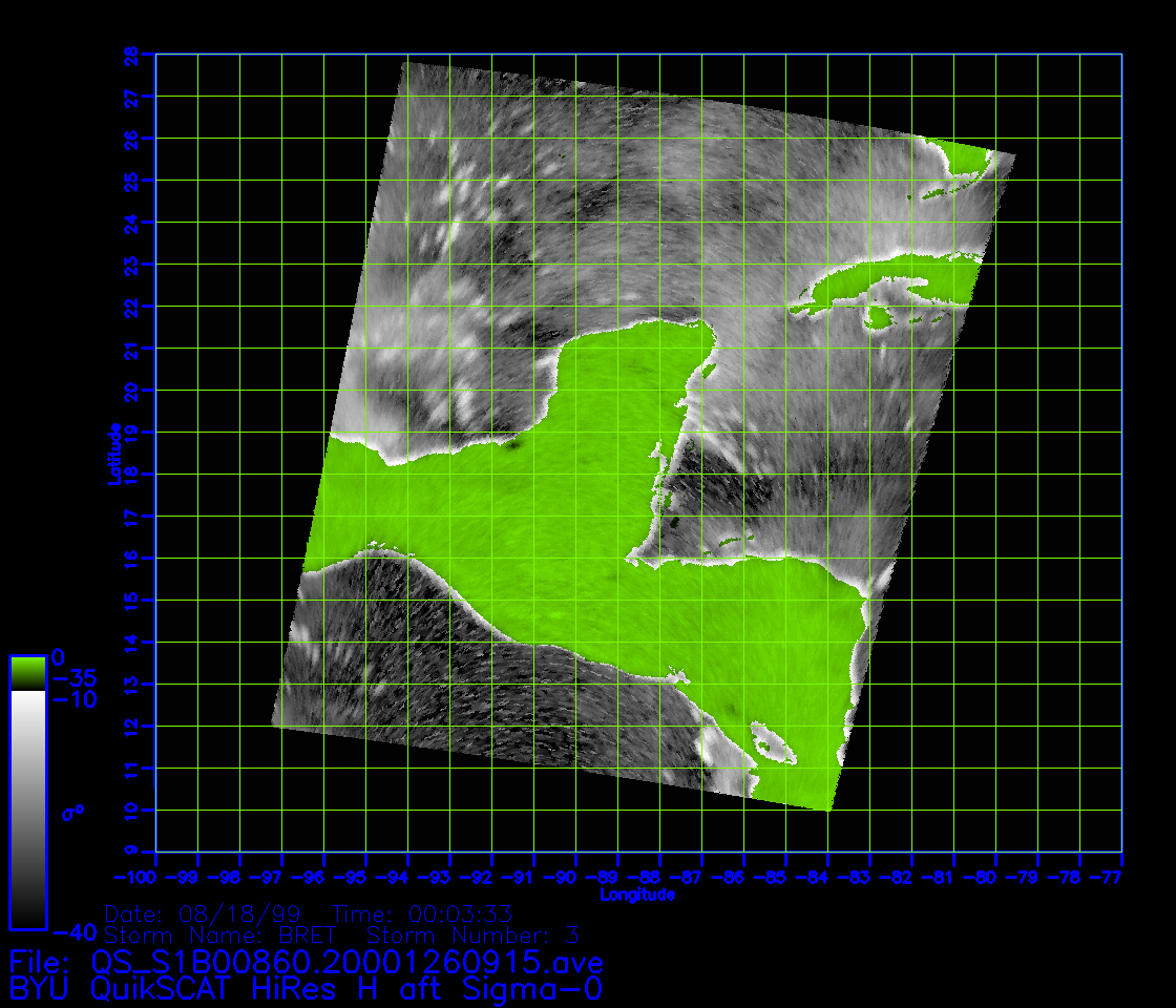
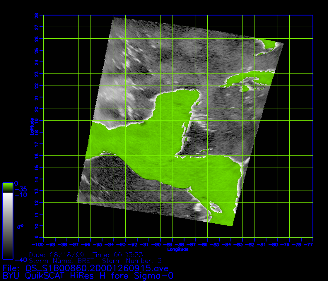
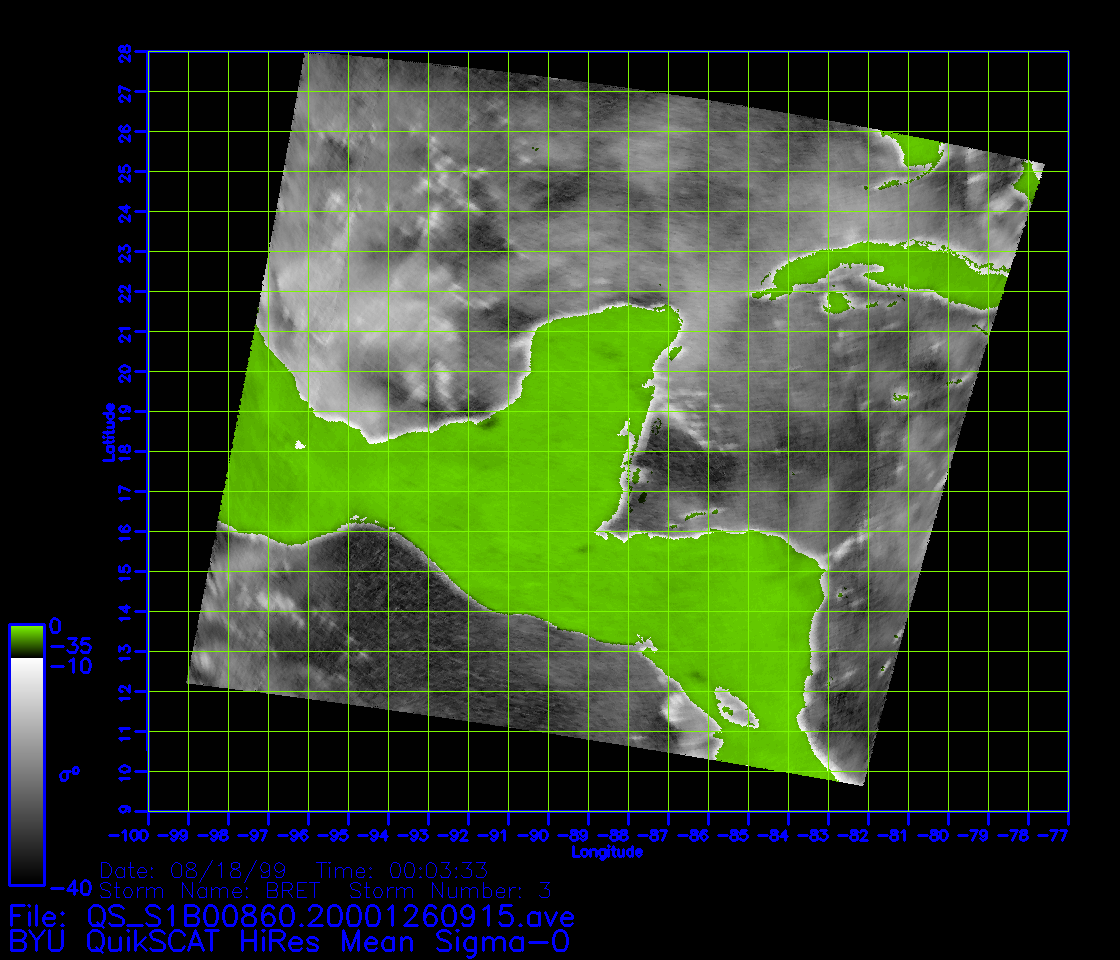
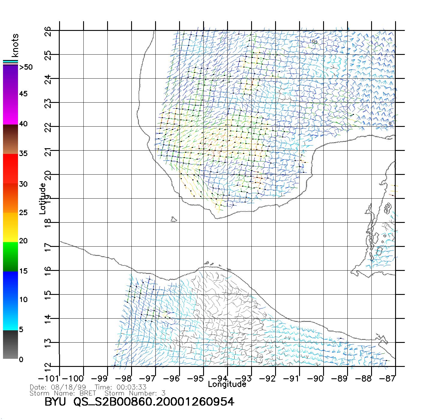
BYU QuikSCAT/SeaWinds Ultra-High Resolution Observations of Tropical Cyclones
Jump to year [1999] | [2000] | [2001] | [2002] | [2003] | [2004] | [2005] | [2006] | [bottom notes] * Please note that ultra-high resolution winds are an experimental product produced at 2.5 km/pixel and have significant limitations, particularly near coasts. Performance varies across the swath. Ambiguity removal performance is somewhat worse than conventional 25 km winds. Product validation continues and is encouraging but does point to the fact that the high resolution estimates are noisy and can be biased, particularly at low wind speeds. Note that ultra high resolution winds currently have no rain flag, but show clear evidence of rain contamination (e.g. individual convective systems can be distinguished in many places.). ** Software (C, Fortran, Matlab, IDL) for reading BINARY high resolution wind files files are available from the Scatterometer Climate Record Pathfinder (SCP) anonymous file Site in the outgoing/data/HRsoftware/HRwind subdirectory. *** SeaWinds cases are only in 2003 and are distinguished from QuikSCAT by the lower rev number. Time code is HHMMSS. Compared with standard resolution winds, ultra-high resolution winds provide additional storm structure such as inner core size and structure and the presence of multiple eyewalls. The 2.5 km winds are also able to observe storms nearer to the shore than 25 km winds. Because of the additional storm detail, center fixes are more accurately obtained from resolution enhanced winds than standard resolution winds. More information. QuikSCAT/SeaWinds Storm co-location text data base. BYU file site ftp.scp.byu.edu/data/qscat/HRStorms R.R. Halterman and D.G. Long, "Comparison of Hurricane Eye Determine Using Standard and Ultra-High Resolution QuikSCAT Winds," Proceedings of the International Geoscience and Remote Sensing Symposium, Denver, Colorado, 31 Jul. – 4 Aug. 2006. D.G. Long and J.B. Luke, "High Resolution Wind Retrieval for SeaWinds," in Proceedings of SPIE Vol. 5155 Ocean Remote Sensing and Imaging II, ed. R.J. Frouin, G.D. Filbert, D. Pan (SPIE, Bellingham, WA), pp. 216-225, 2003. Real-time ultra high resolution wind and related products based on our algorithms are available from NOAA courtesy of Paul Chang. |
||||||||||||||||||||||||||||||||||||||||||||||||||||||||||||||||||||||||||||||||