| Home Page | |
| FAQ | |
| Publications | |
| Documentation | |
| Software | |
| Movies | |
| Image Gallery | |
| Image Data | |
| Data Search | |
| Derived Products | |
| Related Links | |
| Contact Us | |
| SCP file site | |
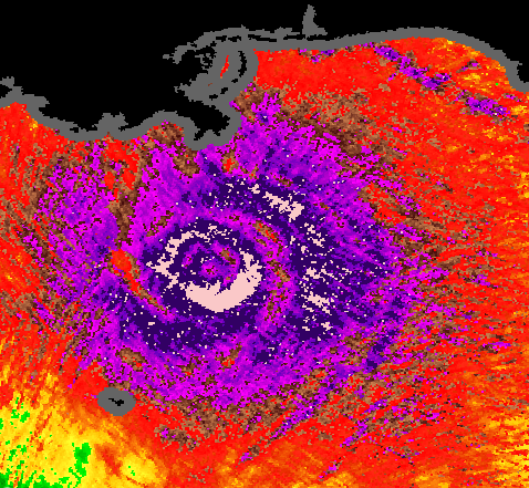
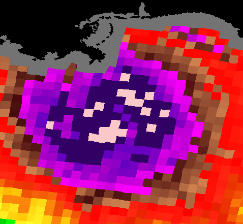
QuikSCAT/SeaWinds Ultra-High Resolution Observation of Tropical Cyclones Resolution enhancement algorithms such as those used for making enhanced resolution sigma-0 images over land, can also be applied to QuikSCAT and SeaWinds over-ocean data due the high sampling density. Further, enhanced resolution backscatter images can be generated from single pass, single azimuth look measurements, enabling wind retrieval at the pixel resolution of the imagery—about 2.5 km posting. Compared with standard resolution winds, ultra-high resolution winds provide additional storm structure such as inner core size and structure and the presence of multiple eyewalls. The 2.5 km winds are also able to observe storms nearer to the shore than 25 km winds. Because of the additional storm detail, center fixes are more accurately obtained from resolution enhanced winds than standard resolution winds. (See Halterman, R. R., and D.G. Long, "Comparison of Hurricane Eye Determine Using Standard and Ultra-High Resolution QuikSCAT Winds," Proceedings of the International Geoscience and Remote Sensing Symposium, Denver, Colorado, 31 Jul. – 4 Aug. 2006.) Several image/data products for every (over 6000 in total) QuikSCAT/SeaWinds observation of National Hurricane Center (NHC) or Joint Typhoon Warning Center (JTWC) tracked tropical cyclones from 1999 through 2005 are being distributed through the Scatterometer Climate Record Pathfinder (SCP) anonymous file Site in the data/qscat/HRStorms directory. The file directory structure and the available products are described below. Real-time ultra high resolution wind and related products based on our algorithms are available from NOAA courtesy of Paul Chang. The QuikSCAT/Storm co-location text file is available here. For each QuikSCAT/Storm co-location it includes information about the time/date of the observation, the QuikSCAT/SeaWinds rev number, the interpolated NHC/JTWC best-track storm location, and other information from the best-track files. Note: This file includes both QuikSCAT and SeaWinds storm co-locations. All SeaWinds co-locations occur during the 2003 year and are differentiated from QuikSCAT co-locations by their much lower rev number (e.g. 1700 vs. 19900). Please note that ultra-high resolution winds are an experimental product produced from NRT data and have significant limitations, particularly near coasts. Performance varies across the swath. Ambiguity removal performance is somewhat worse than conventional 25 km winds. Product validation continues and is encouraging but does point to the fact that the high resolution estimates are noisy and can be biased, particularly at low wind speeds. Note that ultra high
Data is available via file, though a web page inteface is available (it loads slowly due to its large size). The file site sub-directory structure is: ftp.scp.byu.edu/data/qscat/HRStorms/<BASIN>/<SEASON>/<STORM>/<FILE>
The images/products available through the SCP anonymous file Site include:
All images are plotted on a lat/lon grid. Single pass ocean backscatter images have 2.5 km/pixel image resolution. The *.gif image sizes are on the order of 1500x1500 pixels. Software (C, Fortran, Matlab, IDL) for reading BINARY high resolution wind files (*_WRave3) files are available from the Scatterometer Climate Record Pathfinder (SCP) anonymous file Site in the software/HRsoftware/HRwind subdirectory. Contact David Long for additional high resolution wind files. |