|
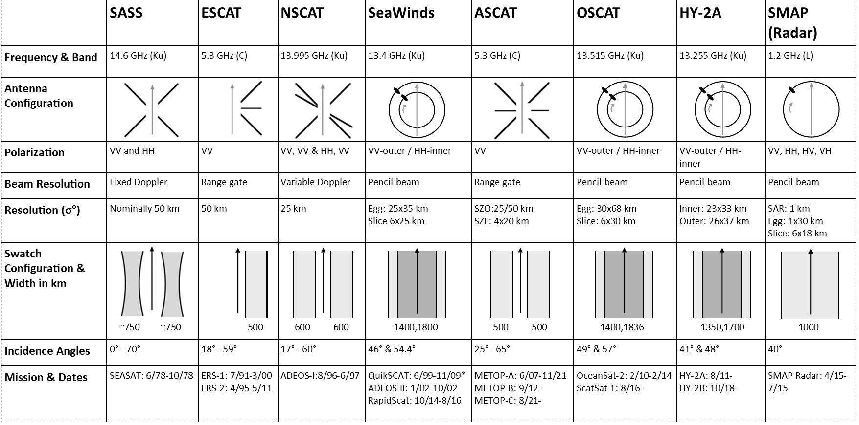
By JPL convention the SeaWinds instrument flown on the QuikSCAT satellite is termed "QuikSCAT", while the SeaWinds instrument flown on ADEOS2/Midori2 is termed "SeaWinds". The SeaWinds Tandem mission refers to combined QuikSCAT and SeaWinds data during the mission overlap period. The scatterometer mode data from the Earth Resource Mission 1 and 2 Advanced Microwave Instruments are referred to as ERS1 and ERS2 or as ESCAT. The Advanced Scatterometer (ASCAT) series of instruments flew on the ESA Metop-A/B/C platforms. The scatterometers operating on OceanSat-2 and SCATsat-1 are known as OSCAT1 and OSCAT2, respectively. Not shown is the Tropical Rain Mapping Mission (TRMM) Precipitation Radar (TRMM-PR) which collected Ku-band surface backscatter at low incidence angles over a narrow swath.
SeaWinds/QuikSCAT, OSCAT, and HY-2A comparison
|